Overview of the southern-most point of the layout plan includes the New Orleans Public Belt RR (NOPB-RR) track which parallels with the Mississippi River in downtown New Orleans just outside of the French Quarter and the heart of The Marigny neighborhood. Norfolk Southern (NS) interchange with the NOPB-RR and track turns northward toward Lake Pontchartrain with the NS Oliver Yard.
Possible elements in this LDE include:
- Governor Nicholls St. Wharf / Esplanade Avenue Wharf – Siding
- TCI Trucking – Housed inside Governor Nicholls St. Wharf
- French Market Station (RTA Red Line Street Car Line)
- ITM Building
- Canal Street
- Esplanade Avenue
- N. Peters Street
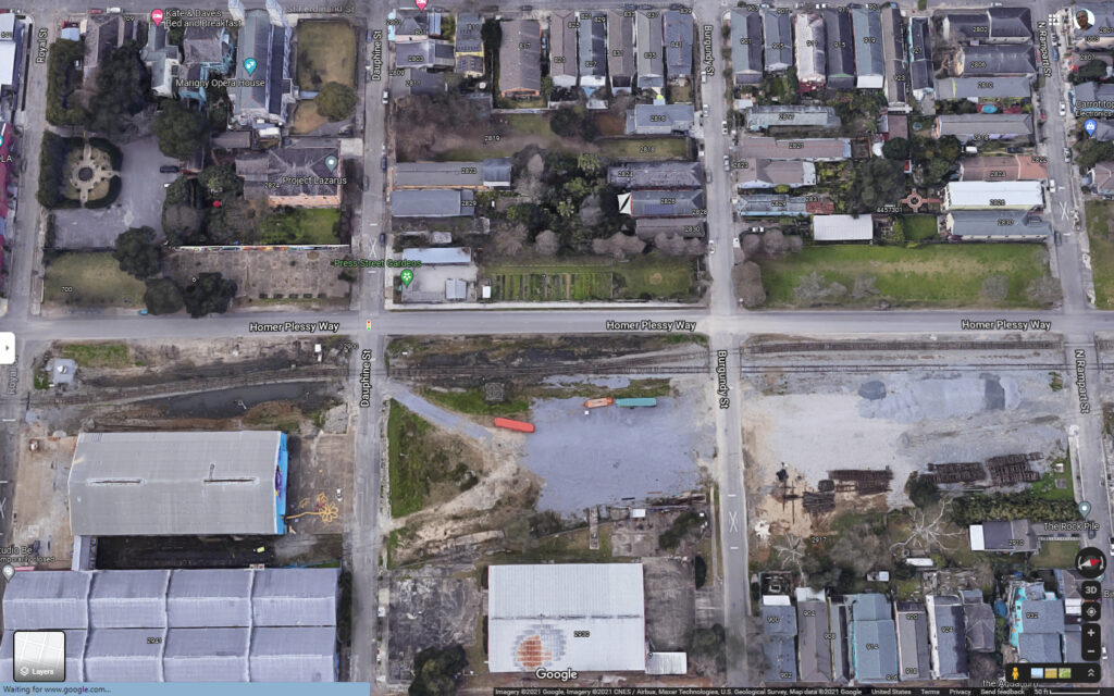
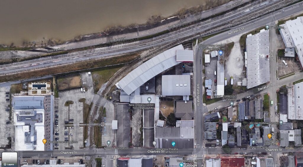
The layout plan shows the track alignment and interchange with the NOPB-RR and NS diverging from the Mississippi River with warehouses, schools, apartments, and hotels.
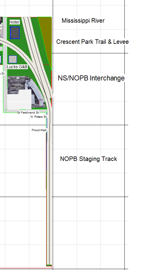
The track plan closely approximates the satellite imagery view of the NS-NOBP-RR interchange location in NOLA, the following images show the prototype alignments, urban setting, track arrangements, buildings, and roads: